E-2 C15-2022-0021 ADV PACKET — original pdf
Backup
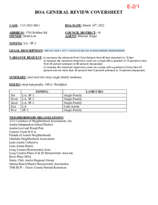
BOA GENERAL REVIEW COVERSHEET CASE: C15-2022-0021 BOA DATE: March 14th, 2022 ADDRESS: 3701 Robbins Rd OWNER: Heidi Lew COUNCIL DISTRICT: 10 AGENT: Bhavani Singal ZONING: LA / SF-2 LEGAL DESCRIPTION: ABS 437 SUR 1 JETT J ACR 0.50 OR LOT B OAK SHORES UNRECORDED VARIANCE REQUEST: a) decrease the minimum Front Yard Setback from 40 feet (required) to 15 feet b) increase the maximum impervious cover on a slope with a gradient of 15 percent or less from 35 percent (allowed) to 48 percent (requested) c) increase the maximum impervious cover on a slope with a gradient of more than 25 percent and not more than 35 percent from 5 percent (allowed) to 14 percent (requested) SUMMARY: erect new two story single-family residence ISSUES: steep topography; 100 yr. floodplain ZONING LAND USES Site North South East West LA; SF-2 LA; SF-2 LA; SF-2 LA SF-2 Single-Family Single-Family Single-Family Lake Austin Single-Family NEIGHBORHOOD ORGANIZATIONS: 2222 Coalition of Neighborhood Associations, Inc. Austin Independent School District Austin Lost and Found Pets Canyon Creek H.O.A. Friends of Austin Neighborhoods Glenlake Neighborhood Association Lake Austin Collective Lake Austin Ranch Long Canyon Homeowners Assn. Long Canyon Phase II & III Homeowners Assn Inc. River Place HOA Sierra Club, Austin Regional Group Steiner Ranch Master Homeowners Association TNR BCP – Travis County Natural Resources E-2/1 E-2/2 E-2/3 E-2/4 E-2/5 E-2/6 City of Austin Development Services Department Land Status Determination 1995 Rule Platting Exception June 07, 2021 File Number: C8I-2021-0231 Address: 3701 ROBBINS RD Tax Parcel I.D. # 0133210306 Tax Map Date: 6/7/2021 The Development Services Department has determined that this parcel, as described in the attached description and map, IS EXCEPTED FROM THE REQUIREMENT TO PLAT in accordance with the Land Development Code, Section 25-4-2(C), and is eligible to receive utility service. The parcel of land consists of five acres or less, and is described as being all of that 0.505 acre of land, more or less, out of the James Jett survey NO.1, Abstract NO. 437 in Travis County, Texas in the current deed, recorded on October 15, 2020, in Document #2020193945, Travis County Deed Records. This parcel existed in its current configuration on January 1, 1995, as evidenced by a deed recorded on October 08, 1984, in Volume 8840, Page 197, Travis County Deed Records. The parcel was lawfully receiving utility service, as defined in Section 212.012 of the Texas Local Government Code, on January 1, 1995, as evidenced by electric service on June 14, 1979. The parcel meets the requirements of the Land Development Code for roadway frontage and is located on an existing street. This determination of the status of the property is based on the application of Chapter 212, Municipal Regulation of Subdivisions and Property Development, Texas Local Government Code; and the City of Austin Land Development Code, Chapter 25-4, Subdivision. Recognition hereby does not imply approval of any other portion of the City Code or any other regulation. By: Amy Combs Representative of the Director Development Services Department E-2/7 E-2/8 E-2/9 E-2/10 E-2/11 E-2/12 E-2/13 E-2/14 E-2/15 E-2/16 E-2/17 E-2/18 E-2/19 E-2/20 E-2/21 E-2/22 E-2/23 TRANSPORTATION AND NATURAL RESOURCES STEVEN M. MANILLA, P.E., EXECUTIVE MANAGER FLOOD ZONE INFORMATION REQUEST FORM NOTICE: This request is for any property located OUTSIDE any incorporated city. Requests must be submitted in writing and include the following: Street Address, and Legal Description of TAX Parcel ID or Subdivision Information. Requests WILL NOT BE PROCESSED without this information, Please allow (7) days to process. Date: Property Address:_________________________________________________ Legal Description: Lot Block Phase Section____________ Subdivision:____________________________________________________________________ OR Tax Parcel ID Number__________________________________________________________________________ Company Name: Requested By:_______________________________ Mailing Address:________________________________________________________________ Telephone:___________________________ FAX:_________________________________ After completion, please mail to Travis County TNR, P.O. Box 1748, Austin, Texas 78767 ATTN: Permits, Contact us at (512) 854-4215 OR FAX (512) 854-4649 INFORMATION TO BE PROVIDED BY TRAVIS COUNTY (Do Not write below this line) This data is derived from the Flood Insurance Rate Maps and should be used for insurance purposes ONLY. Community No. 481026________ Flood Zone Determination By:__________________ Panel No. Date: Precinct:_________________ Flood Zone:________________________________ Date of FIRM: 9/26/08_________ Additional Comments: _____________________________________________________________ ______________________________________________________________________________ 100-year flood plain (designated flood hazard area, having 1% chance of occurring during any year). Areas of 500-year flood, areas of 100-year flood with average depths of less than 1 foot or with drainage areas less than 1 square mile; and areas protected by levees from 100-year flood NOTE: A Travis County Basic Development Permit must be issued, obtained and posted on the site BEFORE ANY CONSTRUCTION WORK MAY BEGIN. For further information, please call Permits at (512) 854-4215. C:\Users\CasertS\AppData\Local\Microsoft\Windows\Temporary Internet Files\Content.Outlook\G8LZFPZF\Flood Zone Information Request Form (2).doc E-2/24 E-2/25 Legend Addresses Jurisdiction FULL PURPOSE LIMITED PURPOSE OTHER CITY LIMITS OTHER CITIES ETJ Jurisdiction FULL PURPOSE LIMITED PURPOSE EXTRATERRITORIAL JURISDICTION 2 MILE ETJ AGRICULTURAL AGREEMENT EXTRATERRITORIAL JURISDICTION 2 MILE ETJ AGRICULTURAL AGREEMENT OTHER CITY LIMITS OTHER CITIES ETJ 0.0 0 0.02 0.0 Miles NAD_1983_StatePlane_Texas_Central_FIPS_4203_Feet Date Printed: This product is for informational purposes and may not have been prepared for or be suitable for legal, engineering, or surveying purposes. It does not represent an on-the-ground survey. This product has been produced by the City of Austin for the sole purpose of geographic reference. No warranty is made by the City of Austin regarding specific accuracy or completeness. 1: 1,200 Notes E-2/26