C-1 C15-2020-0050 ADV PACKET PART3 — original pdf
Backup
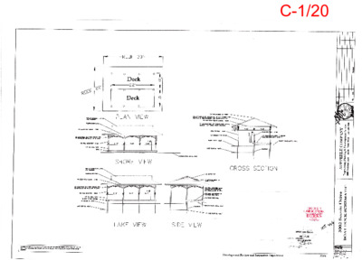
C-1/20 C-1/21 CITY OF AUSTIN – DEVELOPMENT SERVICES DEPARTMENT SITE PLAN APPLICATION – MASTER COMMENT REPORT CASE NUMBER: REVISION #: CASE MANAGER: SP-2020-1025C 0 Clarissa E. Davis UPDATE: U0 PHONE #: 512-974-1423 PROJECT NAME: LOCATION: BOAT DOCK & BULKHEAD 3002 SCENIC DR SUBMITTAL DATE: REPORT DUE DATE: March 11, 2020 FINAL REPORT DATE: March 12, 2020 February 11, 2020 1 DAY HAS BEEN ADDED TO THE UPDATE DEADLINE STAFF REPORT: This report includes all staff comments received to date concerning your most recent site plan submittal. The comments may include requirements, recommendations, or information. The requirements in this report must be addressed by an updated site plan submittal. The site plan will be approved when all requirements from each review discipline have been addressed. However, until this happens, your site plan is considered disapproved. Additional comments may be generated as a result of information or design changes provided in your update. If you have any questions, problems, concerns, or if you require additional information about this report, please do not hesitate to contact your case manager at the phone number listed above or by writing to the City of Austin, Development Services Department, P.O. Box 1088, Austin, Texas 78767. UPDATE DEADLINE (LDC 25-5-113): It is the responsibility of the applicant or their agent to update this site plan application. The final update to clear all comments must be submitted by the update deadline, which is December 31, 2020. Otherwise, the application will automatically be denied. If this date falls on a weekend or City of Austin holiday, the next City of Austin workday will be the deadline. UPDATE SUBMITTALS: A formal update submittal is required. Please bring a copy of this report with you upon submittal to Intake. Updates may be submitted between the hours of 8:30 am and 4:00 pm. Updates submitted after 3 pm may be processed on the following business day. Please submit 6 copies of the plans and 6 copies of a letter that address each comment for distribution to the following reviewers. Clearly label information or packets with the reviewer’s name if intended for a specific reviewer. No distribution is required for the Planner 1 and only the letter is required for Austin Water Utility Development Services. Please note: if Austin Water rejects a plan on Update 2, a fee is due at or before resubmittal. Please contact Intake for the fee amount. REVIEWERS: Planner 1 : Addison Ptomey City Arborist : Cinthia Pedraza Environmental : Pamela Abee-Taulli Flood Plain : Shesh Koirala Hydro Geologist : Radmon Rice Site Plan : Clarissa E. Davis Wetlands Biologist : Brent Bellinger AGENT REPLY TO COMMENTS PREPARED BY RICK RASBERRY ON MARCH 23, 2020 C-1/22 Flood Plain Review - Shesh Koirala - 512-974-9396 1. Per LDC 25-7-33 Please update the FIRM panel number and effective date to the most current map. For this site the current effective FIRM panel number is 48453C0445K effective on 01/22/2020. Agent Reply – FIRM Panel Number and Effective Date Added. 2. Please delineate and clearly label the location of the 100-year Floodplain on site plan sheets per LDC 25-7-33. Agent Reply – 100-year floodplain included on site plan sheets per LDC 25-7-33. 3. For ease of review and to ensure compliance with LDC 25-7-93 and LDC 25-7-96, please include the following elevations on the plan and profile sheets of the dock: Elevation of the lowest structural member (bottom of the concrete deck, or supporting beam), Elevation of the top of the deck, and a reference to the base flood elevation on the site. Clearly label the base flood elevation in applicable plan sheets. Agent Reply – Elevations labeled and included on plan and profile sheets. Hydro Geologist Review - Radmon Rice - 512-974-3429 HG01 Update0 Please be advised that additional comments may be generated as information is updated. If an update is rejected, reviewers are not able to clear comments based on phone calls, emails, or meetings, but must receive formal updates. Agent Reply – Please let us know of any other comments, thanks! HG02 Update0 Due to the sensitive nature of the Critical Environmental Features (CEFs) on site, all construction activities must occur from the lakeside by barge. Note: this site may be eligible for dredging, not to exceed 25 cubic feet, according to LDC § 25-8-368 (E). Agent Reply – The application and proposed site plan now illustrate all activities to be performed via lakeside barge as required. Site Plan Review - Clarissa E. Davis - 512-974-1423 DOCK, BULKHEADS, AND SHORELINE MODIFICATION SP1. Provide the existing shoreline length and proposed footprint. Agent Reply – The existing shoreline length is 98’ and the proposed replacement dock footprint is 22’X30’. SP-01-0251D RECEIVED AN ADMINISTRATIVE VARIANCE FROM SECTION 25-8-261 OF THE CITY OF AUSTIN'S LAND DEVELOPMENT CODE ON MARCH 20, 2002 TO BUILD A 22'X30' DOCK. THE OWNER IS PROPOSING A 22'X30' REPLACEMENT DOCK-- PROPOSED FOOTPRINT OF 719 SQ.FT. SP2. Is the dock being completely demolished and rebuilt or maintained? Agent Reply -- The existing 33’X30’ non-conforming dock is to be completely removed and replaced with a completely new 22’X30’ conforming dock. C-1/23 SP3. Show the existing conditions. Agent Reply – A separate “Existing Conditions illustration” is included on the Site Plan Page 2 for your review. SP4. Show the shoreline setback on the site plan. Agent Reply – The 75’ CWQZ and 25’ LA Zoning setback Aare shown on site plan. SP5. Show the proposed lighting locations on the dock as per LDC 25-2-1175. Agent Reply – The proposed dock lighting per LDC 25-2-1175 is already included on the plans, please advise if the responsible director would require other per LDC? SP6. Add note on the site plan indicating piling size. Agent Reply – The application and proposed plans do include any piling construction, please advise if the responsible director would require other conditions per LDC? SP7. The proposed width of the boat dock does not exceed twenty percent (20%) of the length of the shoreline. Please revise. Agent Reply – The existing shoreline length is 98’ and the proposed replacement dock footprint is 22’X30’. SP-01-0251D RECEIVED AN ADMINISTRATIVE VARIANCE FROM SECTION 25-8-261 OF THE CITY OF AUSTIN'S LAND DEVELOPMENT CODE ON MARCH 20, 2002 TO BUILD A 22'X30' DOCK. THE OWNER IS PROPOSING A 22'X30' REPLACEMENT DOCK-- PROPOSED FOOTPRINT OF 719 SQ.FT. SP8. FYI: All boat docks are now required to be registered with Austin Code Department. More information can be found at: https://www.austintexas.gov/boatdocks or email ACDLicensing@austintexas.gov. Agent Reply – The Owners have been advised of the Austin Code Department purview, thanks! ADMINISTRATIVE SP1. Remove the “Ordinance Certification” notes from the cover sheet. Agent Reply – Notes removed. SP2. Place the case number on all sheets of the plan set. Agent Reply – Case number included. SP3. Place the submittal (December 27th, 2019) date on the cover sheet. Agent Reply – Submittal Date included. SP4. All taxes must be paid prior to site plan approval. Agent Reply – Please see the attached 2019 Tax Certificate secured from Travis County. C-1/24 Wetlands Biologist Review - Brent Bellinger - 512-974-2717 Site was visited by Brent Bellinger and Radmon Rice on 6 March 2020. We confirmed the presence of wetland and rimrock critical environmental features within 150’ of the proposed boat dock. WB1. Update 0. The proposed planting mitigation area I do not feel is appropriate. The area will be heavily shaded by the many trees on site. I recommend utilizing the area down-river of the boat dock, given that the homeowners own both lots. Also, please provide more details as to exactly where plantings will occur. Two of the plants require being placed in shallow water and it is unclear that this is to occur. To clear this comment, please move the proposed mitigation plantings to being sun and water appropriate. Agent Reply – In light of the expert advice please consider the updated planting plan for consideration, thank you! WB2.Update 0. Per discussions with the homeowners, the single cut-in boat slip on the neighboring property, along with an area in the channel, could be dredged up to 25 cu yards to provide use of the existing boat slip and ease of access for construction equipment rather than going overland. Agent Reply – The plans have been revised to propose that all construction activities occur from lakeside barge as required by the reviewing Hydro Geologist, Mr. Rice. City Arborist Review - Cinthia.Pedraza@austintexas.gov CA1 Please provide tree protection fence for all trees located within or immediately adjacent to the LOC that are proposed to be preserved. Agent Reply – Tree protection is included on all trees located within or immediately adjacent to the LOC CA2 Remove silt fence from the critical root zone of tree 424 and replace with mulch socks. Silt fence requires 6” of cut for installation. Agent Reply – Silt fence removed as all materials will now be stored on barge. CA3 For urban forest accounting purposes, please provide the following information on the plan after all landscaping and/or tree-related comments are cleared: Total Appendix F tree inches surveyed; Total Appendix F tree inches removed; Total Non-Appendix F and Invasive removed; Total mitigation inches planted on site; Total dead inches removed; and Total non-mitigation inches planted on site. [ECM 3.5.4] Agent Reply – Please see sheet 4 which already includes this table and advise of any other needs for approval of the update. CA4 Trees proposed to be preserved must meet the following criteria: C-1/25 (1) a minimum of 50% of the critical root zone must be preserved at natural grade, with natural ground cover; (2) cut or fill is limited to 4 inches from the 1/2 critical root zone to the 1/4 critical root zone; and (3) no cut or fill is permitted within the 1/4 critical root zone. [ECM 3.5.2, ECM Appendix V Figure 3-6] - Provide an assessment of canopy pruning required for the proposed pedestrian bridge within the ¼ critical of T379 - Provide proposed pier placement and pier details for all piers within the ½ critical root zone of T379, ensure no piers fall within the ¼ critical. Agent Reply – There are no required piers or pilings associated with the proposed pedestrian access bridge as it is engineered to span directly across to the existing concrete stair landing. There is no proposed grading, filling of the land, and no canopy removal to tree T379 required nor proposed. Please advise if you would like to review the site conditions associated with this dock replacement permit application and we can meet you at the site upon request to go over any other questions or needs. Electric Review - Karen Palacios - 512-322-6110 EL1. Cleared however if an upgrade to the electrical service or reroute of electrical facilities are required please submit for a design below. To better serve our customers, Austin Energy Electric Service Design has begun accepting electric service requests for all projects through an electronic submission form. This includes the Electric Service Planning Application (ESPA). By providing your request through an electronic submission, Austin Energy will be able to manage requests based on submission date and project complexity and Austin Energy personnel will be able to respond to customer requests for information more rapidly. When you submit an intake form to the Austin Energy Electric Service Design Department, you can expect a confirmation of submittal via email. Our website has been updated to include the new form. Take me there! Agent Reply – The Owners have been informed of the AE requirements, thanks! Environmental Review - Pamela Abee-Taulli - 512-974-1879 EV 1 Revise the Watershed note to state that the Watershed is Taylor Slough North, which is classified Cover Sheet Notes Water Supply Suburban. Agent Reply – Note revised. CWQZ, Floodplain, Etc. sheets. [LDC 25-8-92] Agent Reply – Shown. EV 2 Clearly show and label the COA fully-developed floodplain, CWQZ and LA Zoning setback on all EV 3 Use a distinct line symbol for the LOC. Provide a legend and add the LOC line symbol to the Erosion and Sedimentation Sheet legend. Agent Reply – LOC delineation and symbol for LOC included. EV 4 The LOC must include access to the road, since all work is proposed to be done from land. C-1/26 Agent Reply – Per the requirements of the WPD responsible director (see HG02) all proposed work is now proposed via lakeside barge and the LOC has been updated accordingly. EV 5 The contour lines disappear after the 495 contour. Show all the contour lines. Review of the area proposed for staging and storage is pending. Agent Reply – All 2-foot contouring is included in the plans – the top of existing bulkhead is 494 msl and the area from 495 down is relatively flat. EV 6 Correct the table of contents. Agent Reply – Please advise what correction would be required to the table of contents. EV 7 Additional ESC comments pending decision about how construction area will be accessed. Agent Reply – Per the requirements of the WPD responsible director (see HG02) all proposed work is now proposed via lakeside barge and the LOC/ESC conditions have been updated accordingly. EV 8 On the ESC sheet, hatch the area where the LOC enters into the CWQZ. Agent Reply – The 75’ CWQZ setback and LOC are clearly delineated/hatched on the Site Plan Sheet #2. Please advise what other specific updates would be required for the ESC Sheet #4? EV 9 If dredging is proposed, include the following note: “Dredge material shall be disposed dry in a legally permitted landfill site. Prior to offsite disposal, the permittee shall provide the environmental inspector with the address and contact number for the disposal site. Disposal of dredge spoil in the lake is specifically prohibited.” Also note that no spoils are allowed within the 100-year floodplain. Agent Reply – No dredging is proposed with the dock replacement. EV 10 If dredging, add a scaled section that shows existing water line, existing and proposed grade of dredging. Also calculate the amount of mud/soil removed in cubic yards and clearly label the amount on the section. Agent Reply – No dredging is proposed with the dock replacement. EV 11 Provide an Existing Conditions plan and clearly show all proposed demolition of existing structures and include this area in the LOC. Be advised that any ground disturbance resulting from the demolition will trigger revegetation requirements. Agent Reply – An existing conditions illustration has been added to the Site Plan Sheet #2 and the revegetation requirements conform with the LDC and ECM. EV 12 Verify that no grading is proposed. [LDC 25-8-341, 25-8-342] Agent Reply – No grading is proposed with the dock replacement plans and application. Fees and Fiscal Surety EV 13 Provide payment of the site plan environmental inspection fee prior to permit/site plan approval. Obtain the invoice at COA Intake, or by calling 512-974-1770. Payment of the fee may be made at the first floor Cashier’s Window. This comment will clear by providing a receipt of payment to the Environmental Reviewer. Agent Reply – The Owners are available to pay the invoice upon receipt, thanks! C-1/27 EV 14 Send a fiscal estimate for erosion/sedimentation controls and revegetation based on ECM Appendix S-1 to pamela.abee-taulli@austintexas.gov. The approved amount must be posted with the City prior to permit/site plan approval. 186, ECM 1.2.1, ECM Appendix S-1] [LDC 25-8- NOTE: if all construction access is changed from land to barge, then the fiscal estimate will not be necessary. Agent Reply – Construction access has been changed from land to barge. Planner 1 Review - Addison Ptomey - 512-974-3103 THE FOLLOWING COMMENTS APPLY PRIOR TO THE RELEASE OF THE SITE DEVELOPMENT PERMIT. FYI – An appointment is required in order to receive the site development permit. The permit will be released after the flash drive has been submitted with the Intake Staff and the site plan approval blocks have been finished. Contact the Planner I listed above to set up an appointment to receive the site plan permit. Agent Reply – Please advise of any “flash drive” submittal requirements and we will make sure to get that to you quickly, thanks! FYI – Fill out the Site Plan Approval blocks with the following information in bold. Sheet numbers File number: SP-2020-1025C Application date: December 27, 2019 Under Section 112 of Chapter 25-5 of the City of Austin Code Case Manager: Clarissa Davis Zoning: Please Add the Zoning on the mylars. If the Site Plan Approval Blocks are not filled out, the applicant will need to make an appointment to fill them out by hand. If the applicant wishes the Planner 1 to fill them out, there could be a delay in receiving the site development permit. Agent Reply – This is not a “C” plan and no mylar conditions apply. Roderick has corrected the permit to “D” accordingly. FYI – FLASH DRIVE REQUIREMENT All applications submitted for completeness check after 5/10/10 for Administrative Site Plan Revision, Consolidated Site Plan, Non-Consolidated Site Plan, CIP Streets and Drainage, Major Drainage/Regional Detention, and Subdivision Construction Plans will require the additional items listed in the Electronic Submittal Exhibit of the application packet on a USB flash drive prior to release of permit. The flash drive must be taken directly to the Planner 1 on this report by the applicant once all comments are cleared. Agent Reply – Please advise of any “flash drive” submittal requirements and we will make sure to get that to you quickly, thanks! END OF REPORT AGENT REPLY TO COMMENTS PREPARED BY RICK RASBERRY ON MARCH 23, 2020 P1. P2. P3. C-1/28 C-1/29 CITY OF AUSTIN – DEVELOPMENT SERVICES DEPARTMENT SITE PLAN APPLICATION – MASTER COMMENT REPORT CASE NUMBER: REVISION #: CASE MANAGER: SP-2020-1025D 0 Clarissa E. Davis UPDATE: U1 PHONE #: 512-974-1423 PROJECT NAME: LOCATION: BOAT DOCK & BULKHEAD 3002 SCENIC DR Bldg BD SUBMITTAL DATE: REPORT DUE DATE: April 15, 2020 FINAL REPORT DATE: April 16, 2020 April 1, 2020 1 DAY HAS BEEN ADDED TO THE UPDATE DEADLINE STAFF REPORT: This report includes all staff comments received to date concerning your most recent site plan submittal. The comments may include requirements, recommendations, or information. The requirements in this report must be addressed by an updated site plan submittal. The site plan will be approved when all requirements from each review discipline have been addressed. However, until this happens, your site plan is considered disapproved. Additional comments may be generated as a result of information or design changes provided in your update. If you have any questions, problems, concerns, or if you require additional information about this report, please do not hesitate to contact your case manager at the phone number listed above or by writing to the City of Austin, Development Services Department, P.O. Box 1088, Austin, Texas 78767. UPDATE DEADLINE (LDC 25-5-113): It is the responsibility of the applicant or their agent to update this site plan application. The final update to clear all comments must be submitted by the update deadline, which is January 1, 2021. Otherwise, the application will automatically be denied. If this date falls on a weekend or City of Austin holiday, the next City of Austin workday will be the deadline. UPDATE SUBMITTALS: A formal update submittal is required. Please bring a copy of this report with you upon submittal to Intake. Updates may be submitted between the hours of 8:30 am and 4:00 pm. Updates submitted after 3 pm may be processed on the following business day. Please submit 4 copies of the plans and 4 copies of a letter that address each comment for distribution to the following reviewers. Clearly label information or packets with the reviewer’s name if intended for a specific reviewer. No distribution is required for the Planner 1 and only the letter is required for Austin Water Utility Development Services. Please note: if Austin Water rejects a plan on Update 2, a fee is due at or before resubmittal. Please contact Intake for the fee amount. REVIEWERS: Planner 1 : Addison Ptomey Site Plan : Clarissa E. Davis Wetlands Biologist : Brent Bellinger Environmental : Pamela Abee-Taulli Hydro Geologist : Radmon Rice AGENT REPLY TO COMMENTS PREPARED BY RICK RASBERRY ON APRIL 21, 2020 C-1/30 Hydro Geologist Review - Radmon Rice - 512-974-3429 HG01 Update0 updated. If an update is rejected, reviewers are not able to clear comments based on phone calls, Please be advised that additional comments may be generated as information is emails, or meetings, but must receive formal updates. Update1 - Informal update until commission variance determination. Agent Reply HG01 > Please feel free to contact me at 512-970-0371 with any other questions or needs, thanks! HG02 Update0 Due to the sensitive nature of the Critical Environmental Features (CEFs) on site, all construction activities must occur from the lakeside by barge. Note: this site may be eligible for dredging, not to exceed 25 cubic feet, according to LDC § 25-8-368 (E). Update1 - Comment cleared. Please note wetland biologist guidance on dredging likely being necessary in order for barge access. Agent Reply HG02 > Please see DA 2020-062681 which is currently under DAC review requesting site plan exemption to remove less than 25 cubic yards for navigation per rule. Environmental Review - Pamela Abee-Taulli - 512-974-1879 EV 1-7 Cleared EV 8 On the ESC sheet, hatch the area where the LOC enters into the CWQZ. Update 1 Comment not cleared. 1. Explain what work is proposed in the blue hatched area. If no work is proposed, remove this area 2. from the LOC. If work is proposed and the area stays in the LOC, hatch the area and add a callout note stating: “This area requires native grassland seeding and planting per City of Austin Standard Specification 609S.6, including topsoil and seed bed preparation, temporary irrigation, and weed maintenance.” C-1/31 Agent Reply EV8 > Please see the revised LOC which excludes the “blue hatched area”. EV 9-12 Cleared Fees and Fiscal Surety EV 13 Provide payment of the site plan environmental inspection fee prior to permit/site plan approval. Obtain the invoice at COA Intake, or by calling 512-974-1770. Payment of the fee may be made at the first floor Cashier’s Window. This comment will clear by providing a receipt of payment to the Environmental Reviewer. Agent Reply EV13 > Please see that we have requested invoice from COA Intake and the owner is prepared to pay any/all fees online via the ABC account portal. EV 14 Cleared Flood Plain Review - Shesh Koirala - 512-974-9396 Email: shesh.koirala@austintexas.gov (preferred) FP Comments: (U0: Original comment, U1: Update 1 comment) 1. U0: Per LDC 25-7-33 Please update the FIRM panel number and effective date to the most current map. For this site the current effective FIRM panel number is 48453C0445K effective on 01/22/2020. U1: Done 2. U0: Please delineate and clearly label the location of the 100-year Floodplain on site plan sheets per LDC 25-7-33. U1: Done 3. U0: For ease of review and to ensure compliance with LDC 25-7-93 and LDC 25-7-96, please include the following elevations on the plan and profile sheets of the dock: Elevation of the lowest structural member (bottom of the concrete deck, or supporting beam), Elevation of the top of the deck, and a reference to the base flood elevation on the site. Clearly label the base flood elevation in applicable plan sheets. U1: Done Site Plan Review - Clarissa E. Davis - 512-974-1423 DOCK, BULKHEADS, AND SHORELINE MODIFICATION SP1. Provide the existing shoreline length and proposed footprint. C-1/32 U1: This needs to be shown and called out on the site plan sheet. Agent Reply SP1 > Please see that the shoreline frontage (99.5 linear feet) and proposed footprint (719 square feet) are enumerated on the site plan sheet as follows: SP2. Is the dock being completely demolished and rebuilt or maintained? U1: Confirm the square footage includes the deck that is built around the boat dock. Agent Reply SP2 > The existing “deck” is to be removed via demolition and the proposed 719 sf dock does not include any “deck around the dock”? Show the existing conditions. U1: Cleared. Show the shoreline setback on the site plan. U1: Cleared. SP3. SP4. SP5. SP6. Show the proposed lighting locations on the dock as per LDC 25-2-1175. U1: Cleared. Add note on the site plan indicating piling size. U1: Please confirm that no new pilings are being proposed for this site and existing pilings will be used. Agent Reply SP6 > No new pilings are proposed with the dock replacement plans. SP7. The proposed width of the boat dock does not exceed twenty percent (20%) of the length of the shoreline. Please revise. U1: The proposed appears to be 27+ in length. Please confirm or revise. Agent Reply SP7 > Yes, SP-01-0251D RECEIVED AN ADMINISTRATIVE VARIANCE FROM SECTION 25-8-261 OF THE CITY OF AUSTIN'S LAND DEVELOPMENT CODE ON MARCH 20, 2002 TO BUILD A 22'X30' DOCK. THE OWNER IS PROPOSING A 22'X30' REPLACEMENT DOCK-- PROPOSED FOOTPRINT OF 719 SQ.FT INCLUDES THE PROPOSED PEDESTRIAN ACCESS BRIDGE. C-1/33 SP8. FYI: All boat docks are now required to be registered with Austin Code Department. More information can be found at: https://www.austintexas.gov/boatdocks or email ACDLicensing@austintexas.gov. U1: Cleared. SP9. SP10. SP11. ADMINISTRATIVE Remove the “Ordinance Certification” notes from the cover sheet. U1: Cleared. Place the case number on all sheets of the plan set. U1: Cleared. Place the submittal (December 27th, 2019) date on the cover sheet. U1: Cleared. SP12. All taxes must be paid prior to site plan approval. U1: Tax return for 2020 is needed. Please provide. Agent Reply SP12 > There are no taxes due for 2020 but here is another copy of the 2019 Tax Certificate procured from Travis County on March 17, 2020. Wetlands Biologist Review - Brent Bellinger - 512-974-2717 WB1. Update 0. The proposed planting mitigation area I do not feel is appropriate. The area will be heavily shaded by the many trees on site. I recommend utilizing the area down-river of the boat dock, given that the homeowners own both lots. Also, please provide more details as to exactly where plantings will occur. Two of the plants require being placed in shallow water and it is C-1/34 unclear that this is to occur. To clear this comment, please move the proposed mitigation plantings to being sun and water appropriate. WB1. Update 1. Comment cleared. WB2.Update 0. Per discussions with the homeowners, the single cut-in boat slip on the neighboring property, along with an area in the channel, could be dredged up to 25 cu yards to provide use of the existing boat slip and ease of access for construction equipment rather than going overland. WB2. Update 1. Comment remains. Applicant reply did not address this comment. It is unclear how work will be able to be carried out from the water without dredging. The area appeared to be too shallow to allow barge access. On sheet 2, please add detailed depth contours to clarify the depths available for a barge. It is also unclear why the owners are choosing not to dredge out the cut-in slip on the adjacent property. To clear this comment, please directly address the issue raised regarding the need for dredging. Agent Reply WB2 > We have followed your guidance and submitted the requested site plan exemption request with the DAC Office as follows: FOLDER DETAILS Permit/Case: 2020-062681 DA Reference File Name: Description: Exemption Needs review Sub Type: Site Plan Determination/Exemption Work Type: Project Name: 3000 SCENIC DRIVE Status: Pending Application Date: Apr 21, 2020 Issued: Expiration Date: Related Folder: No Please feel free to contact me at 512-970-0371 or rick@rickrasberry.com to coordinate remedy of any continuing disapproval maintained by the WPD Director and thanks for the guidance. Planner 1 Review - Addison Ptomey – Addison.Ptomey@austintexas.gov ELECTRONIC SUBMITTAL REQUIREMENT All Administrative Site Plan Revision, Consolidated Site Plan, Non-Consolidated Site Plan, CIP Streets and Drainage, Major Drainage/Regional Detention, and Subdivision Construction Plan applications require the additional items listed in the Electronic Submittal Exhibit of the application packet (formerly known as flash drive materials). Submit the final electronic submittal with the final PDFs of the plan set at approval and permitting. END OF REPORT AGENT REPLY TO COMMENTS PREPARED BY RICK RASBERRY ON APRIL 21, 2020 C-1/35 C-1/36 CITY OF AUSTIN – DEVELOPMENT SERVICES DEPARTMENT SITE PLAN APPLICATION – MASTER COMMENT REPORT CASE NUMBER: REVISION #: CASE MANAGER: SP-2020-1025D 0 Clarissa E. Davis UPDATE: U2 PHONE #: 512-974-1423 PROJECT NAME: LOCATION: BOAT DOCK & BULKHEAD 3002 SCENIC DR Bldg BD SUBMITTAL DATE: REPORT DUE DATE: May 6, 2020 FINAL REPORT DATE: May 5, 2020 April 22, 2020 STAFF REPORT: This report includes all staff comments received to date concerning your most recent site plan submittal. The comments may include requirements, recommendations, or information. The requirements in this report must be addressed by an updated site plan submittal. The site plan will be approved when all requirements from each review discipline have been addressed. However, until this happens, your site plan is considered disapproved. Additional comments may be generated as a result of information or design changes provided in your update. If you have any questions, problems, concerns, or if you require additional information about this report, please do not hesitate to contact your case manager at the phone number listed above or by writing to the City of Austin, Development Services Department, P.O. Box 1088, Austin, Texas 78767. UPDATE DEADLINE (LDC 25-5-113): It is the responsibility of the applicant or their agent to update this site plan application. The final update to clear all comments must be submitted by the update deadline, which is January 4, 2021. Otherwise, the application will automatically be denied. If this date falls on a weekend or City of Austin holiday, the next City of Austin workday will be the deadline. UPDATE SUBMITTALS: A formal update submittal is required. Please bring a copy of this report with you upon submittal to Intake. Updates may be submitted between the hours of 8:30 am and 4:00 pm. Updates submitted after 3 pm may be processed on the following business day. Please submit 3 copies of the plans and 3 copies of a letter that address each comment for distribution to the following reviewers. Clearly label information or packets with the reviewer’s name if intended for a specific reviewer. No distribution is required for the Planner 1 and only the letter is required for Austin Water Utility Development Services. Please note: if Austin Water rejects a plan on Update 2, a fee is due at or before resubmittal. Please contact Intake for the fee amount. REVIEWERS: Planner 1 : Addison Ptomey Site Plan : Clarissa E. Davis Hydro Geologist : Radmon Rice Wetlands Biologist : Brent Bellinger AGENT REPLY TO COMMENTS PREPARED BY RICK RASBERRY ON MAY 15, 2020 Please accept this appeal request to schedule any commission variance determination in accordance with Article 3. – LAND USE COMMISSION APPROVED SITE PLANS if the responsible director should maintain any disapproval. C-1/37 Hydro Geologist Review - Radmon Rice - 512-974-3429 HG01 Update0 Please be advised that additional comments may be generated as information is updated. If an update is rejected, reviewers are not able to clear comments based on phone calls, emails, or meetings, but must receive formal updates. Update1 - Update2 - Informal update until commission variance determination. Informal update until commission variance determination. Agent Reply HG01 – Please accept this request to schedule any commission variance determination in accordance with Article 3. – LAND USE COMMISSION APPROVED SITE PLANS HG02 Update0 Comment cleared. Site Plan Review - Clarissa E. Davis - 512-974-1423 DOCK, BULKHEADS, AND SHORELINE MODIFICATION SP1. Provide the existing shoreline length and proposed footprint. U2: Cleared. SP2. Is the dock being completely demolished and rebuilt or maintained? U2: Show clear dimensions of the deck so that it may be accurately calculated. For example: The depth of the deck on the left side, the total dimensions of the proposed access. Agent Reply SP2 > All dimensions on the 22’ X 30’ replacement dock footprint is fully enumerated. Please accept this appeal request to schedule any commission variance determination in accordance with Article 3. – LAND USE COMMISSION APPROVED SITE PLANS if the responsible director should maintain any disapproval. SP3. – SP 5 - Cleared. SP6. Add note on the site plan indicating piling size. U2: Cleared. SP7. The proposed width of the boat dock does not exceed twenty percent (20%) of the length of the shoreline. Please revise. U2: The boat dock proposed does not constitute as a remove and replace, as the footprint of the dock is different from the existing. Administrative variance from the 2002 site plan would not be applicable to the new layout. Please revise. Agent Reply SP7 > The 2002 site plan variance was approved by the Land Use Commission (not an “administrative variance”). Please accept this appeal request to schedule any commission variance determination in accordance with Article 3. – LAND USE COMMISSION APPROVED SITE PLANS if the responsible director should maintain any disapproval. SP8. – Cleared. ADMINISTRATIVE SP9. – SP 11 – Cleared. SP10. All taxes must be paid prior to site plan approval. U2: Comment remains. Tax return for 2020 is needed. Please provide. C-1/38 Agent Reply SP12 > There are no taxes due (by law) for 2020 yet but here is another copy of the 2019 Tax Certificate procured from Travis County less than 60 days ago? Wetlands Biologist Review - Brent Bellinger - 512-974-2717 WB2.Update 0. Per discussions with the homeowners, the single cut-in boat slip on the neighboring property, along with an area in the channel, could be dredged up to 25 cu yards to provide use of the existing boat slip and ease of access for construction equipment rather than going overland. WB2. Update 1. Comment remains. Applicant reply did not address this comment. It is unclear how work will be able to be carried out from the water without dredging. The area appeared to be too shallow to allow barge access. On sheet 2, please add detailed depth contours to clarify the depths available for a barge. It is also unclear why the owners are choosing not to dredge out the cut-in slip on the adjacent property. To clear this comment, please directly address the issue raised regarding the need for dredging. WB2. Update 2. Informal comment. Applicant submitted a site plan exemption for dredging; however, the request was made initially (see update 0 comment) by this reviewer to include dredge with the current site plan to ensure adequate review. To clear this informal comment, please provide to me and the case manager, through email, the dredge request submitted to DAC as an update to this site plan that shows the location of the proposed dredge, the dredge footprint (i.e., length, depth, width for determination of volume being removed), adequate turbidity controls, and the expanded LOC. C-1/39 Agent Reply WB2 > Please see sheet 5 of the updated plans for the proposed dredge requirements. Planner 1 Review - Addison Ptomey – Addison.Ptomey@austintexas.gov ELECTRONIC SUBMITTAL REQUIREMENT All Administrative Site Plan Revision, Consolidated Site Plan, Non-Consolidated Site Plan, CIP Streets and Drainage, Major Drainage/Regional Detention, and Subdivision Construction Plan applications require the additional items listed in the Electronic Submittal Exhibit of the application packet (formerly known as flash drive materials). Submit the final electronic submittal with the final PDFs of the plan set at approval and permitting. END OF REPORT AGENT REPLY TO COMMENTS PREPARED BY RICK RASBERRY ON MAY 15, 2020 Please accept this appeal request to schedule any commission variance determination in accordance with Article 3. – LAND USE COMMISSION APPROVED SITE PLANS if the responsible director should maintain any disapproval. C-1/40 CITY OF AUSTIN – DEVELOPMENT SERVICES DEPARTMENT SITE PLAN APPLICATION – MASTER COMMENT REPORT CASE NUMBER: REVISION #: CASE MANAGER: SP-2020-1025D 0 Clarissa E. Davis UPDATE: U3 PHONE #: 512-974-1423 PROJECT NAME: LOCATION: BOAT DOCK & BULKHEAD 3002 SCENIC DR Bldg BD May 15, 2020 SUBMITTAL DATE: REPORT DUE DATE: June 1, 2020 FINAL REPORT DATE: May 28, 2020 STAFF REPORT: This report includes all staff comments received to date concerning your most recent site plan submittal. The comments may include requirements, recommendations, or information. The requirements in this report must be addressed by an updated site plan submittal. The site plan will be approved when all requirements from each review discipline have been addressed. However, until this happens, your site plan is considered disapproved. Additional comments may be generated as a result of information or design changes provided in your update. If you have any questions, problems, concerns, or if you require additional information about this report, please do not hesitate to contact your case manager at the phone number listed above or by writing to the City of Austin, Development Services Department, P.O. Box 1088, Austin, Texas 78767. UPDATE DEADLINE (LDC 25-5-113): It is the responsibility of the applicant or their agent to update this site plan application. The final update to clear all comments must be submitted by the update deadline, which is January 4, 2021. Otherwise, the application will automatically be denied. If this date falls on a weekend or City of Austin holiday, the next City of Austin workday will be the deadline. UPDATE SUBMITTALS: A formal update submittal is required. Please bring a copy of this report with you upon submittal to Intake. Updates may be submitted between the hours of 8:30 am and 4:00 pm. Updates submitted after 3 pm may be processed on the following business day. Please submit 2 copies of the plans and 2 copies of a letter that address each comment for distribution to the following reviewers. Clearly label information or packets with the reviewer’s name if intended for a specific reviewer. No distribution is required for the Planner 1 and only the letter is required for Austin Water Utility Development Services. Please note: if Austin Water rejects a plan on Update 2, a fee is due at or before resubmittal. Please contact Intake for the fee amount. REVIEWERS: Planner 1 : Addison Ptomey Site Plan : Clarissa E. Davis Hydro Geologist : Radmon Rice C-1/41 Site Plan Review - Clarissa E. Davis - 512-974-1423 DOCK, BULKHEADS, AND SHORELINE MODIFICATION SP1. – Cleared. SP2. Is the dock being completely demolished and rebuilt or maintained? U3: A variance would need to be sought after via the Board of Adjustments. Please contact the BOA liaison, Elaine Ramirez for more information on the process (Elaine.Ramirez@austintexas.gov). Once you receive the determination, please provide it to this reviewer. SP3. – SP 6 - Cleared. SP7. The proposed width of the boat dock does not exceed twenty percent (20%) of the length of the shoreline. Please revise. U3: A variance would need to be sought after via the Board of Adjustments. Please contact the BOA liaison, Elaine Ramirez for more information on the process (Elaine.Ramirez@austintexas.gov) Once you receive the determination, please provide it to this reviewer. SP8. – Cleared. ADMINISTRATIVE SP9. – SP 11 – Cleared. SP10. All taxes must be paid prior to site plan approval. U3: Comment remains. All taxes must be paid prior to site plan approval. Please provide. Hydro Geologist Review - Radmon Rice - 512-974-3429 HG01 Update0 Please be advised that additional comments may be generated as information is updated. If an update is rejected, reviewers are not able to clear comments based on phone calls, emails, or meetings, but must receive formal updates. Update1 - Informal update until commission variance determination. Wetlands Biologist Review - Brent Bellinger - 512-974-2717 All comments have been cleared. Planner 1 Review - Addison Ptomey – Addison.Ptomey@austintexas.gov ELECTRONIC SUBMITTAL REQUIREMENT All Administrative Site Plan Revision, Consolidated Site Plan, Non-Consolidated Site Plan, CIP Streets and Drainage, Major Drainage/Regional Detention, and Subdivision Construction Plan applications require the additional items listed in the Electronic Submittal Exhibit of the application packet (formerly known as flash drive materials). Submit the final electronic submittal with the final PDFs of the plan set at approval and permitting. END OF REPORT C-1/42 Rick Rasberry, CESSWI Lake Austin Boat Dock & Shoreline Permits 512-970-0371 Program Manager III, Land Use Review C-1/43 Please note that all information provided is subject to public disclosure via DSD’s open data portal. For more information please visit: City of Austin Ordinance 2016-0922-005 | City Clerk’s website | City Clerk’s FAQ’s C-1/44 Program Manager III, Land Use Review Please note that all information provided is subject to public disclosure via DSD’s open data portal. For more information please visit: City of Austin Ordinance 2016-0922-005 | City Clerk’s website | City Clerk’s FAQ’s C-1/45 Rick Rasberry, CESSWI Lake Austin Boat Dock & Shoreline Permits 512-970-0371 C-1/46 Planner I, Land Use Review Please note that all information provided is subject to public disclosure via DSD’s open data portal. For more information please visit: City of Austin Ordinance 2016-0922-005 | City Clerk’s website | City Clerk’s FAQ’s C-1/47 ENVIRONMENTAL COMMISSION MOTION 20200715-003c Date: July 15, 2020 RATIONALE: Subject: 3002 Scenic Drive Boat Dock Replacement, SP-2020-1025D Motion by: Kevin Ramberg Seconded by: Mary Ann Neely WHEREAS, the Environmental Commission recognizes the applicant requests a variance from LDC 25-8- 281(C)(2)(b) to allow the construction within 150-foot of a Critical Environmental Feature (CEF). WHEREAS, the Environmental Commission recognizes that staff recommends this variance, having determined the findings of fact to have been met. THEREFORE, the variance from LDC 25-8-281(C)(2)(b) to allow the construction within 150-foot of a Critical Environmental Feature (CEF). All construction activities to be completed by barge. Staff Conditions 1. VOTE 11-0 For: Bedford, Creel, Smith, Thompson, Nill, Neely, Coyne, Maceo, Ramberg, Guerrero, and Gordon Against: None Abstain: None Recuse: None Absent: None Approved By: Linda Guerrero, Environmental Commission Chair 1 C-1/48 Director of Development Services Department December 19, 2019 City of Austin P.O. Box 1088 Austin, Texas 78767 Dear Director: Re: Site Plan Revision Application and Project Summary for Proposed Boat Dock Replacement, 3002 Scenic Drive on Lake Austin, TX On behalf of the owners of the referenced property I am presenting the attached site plan revision application and associated records requesting the release of a revised Site Plan (SP-01-0251D) for the development of a conforming Boat Dock, Dock Access, and Necessary Appurtenances in accordance with City Code 25-2-1173. Attached (Exhibit “B”) is the owner’s written authorization letter engaging me to act as the owner’s agent on these matters. The proposed plans and specifications comply with City Code 25-7-62 along with all other parts of City Ordinance No. 20140626-113 Relating to the Lake Austin Zoning District and the Regulation of Boat Docks, Bulkheads, and Shoreline Access. Additionally, the proposed replacement dock footprint will conform with the original 2001 dock footprint approved by the City per SP-01-0251D and accepted by the City per 2002- 012342 BP (Exhibit “R”). Listed below are the attached detailed project summary and records for application, plans, and supporting documents, as follows: Project Summary Acreage to be developed > 0.0165 Acres Watershed in which project is located > North Taylor Slough Type of development > Boat Dock, Dock Access, and Necessary Appurtenances Explanation of any proposed project phasing > None Methods to be used to handle storm water runoff > None Required Effect of the development will have on existing and future drainage systems > None Justification for exemption from the watershed protection regulations > No Variance Requested Erosion/Sedimentation Controls > Any Silt Fence, Turbidity Curtain, and/or any other controls as required by COA Environmental Inspector for the greatest level of environmental, health safety, and navigational protection. Site Plan Revision Application and Project Summary Letter > Provided as Exhibit “A” Agent Authorization Letter > Provided as Exhibit “B” Warranty Deed > Provided as Exhibit “C” Environmental Resource Inventory for the Residential Lot > Provided as Exhibit “D” C-1/49 Director of Development Services Department Site Plan Revision Application and Project Summary, 3002 Scenic Dr on Lake Austin, TX December 19, 2019 Page 2 Soils Map > Provided as Exhibit “E” 2018 Tax Payment Receipt/Certification > Provided as Exhibit “F” Full Size Site Plan (Red Line and Black Line pages in set) > Provided as Exhibit “G” Zoning Profile Report > Provided as Exhibit “H” Engineer’s “No Rise” Floodplain Certification Letter > Provided as Exhibit “I” Floodplain Information Form > Provided as Exhibit “J” Tree Review Addendum > Provided as Exhibit “K” Intake Submittal Checklist > Provided as Exhibit “L” Project Description Form > Provided as Exhibit “M” Location Map on Separate Sheet > Provided as Exhibit “N” Subdivision Plat > Exhibit “O” Exhibit VII Electronic Submittal > Exhibit “P” COA Dock Development Acceptance 2002-012342 BP > Provided as Exhibit “Q” Fiscal Surety Letter > Provided as Exhibit “R” Notice Communication with original SP-01-0251D Engineer of Record > Provided as Exhibit “S” It should be noted that the property owners are seeking no special privilege to replace the boat dock, dock access, and other necessary appurtenances not already given to owners of other similarly situated property with approximately contemporaneous development and as provided. The proposal would result in promoting the ecological function and maintaining the natural character of the lakeshore. Any denial of the requested application for the Site Plan Revision would be construed as deprivation of a privilege given to other property owners and would effectively deny these property owners a reasonable use. Please let me know if you should have any questions or require any additional information. Very truly yours, Rick Rasberry Ricky “Rick” Rasberry, CESSWI CC: Owners Furman + Keil Architects, PLLC C-1/50 C-1/51 C-1/52 C-1/53 C-1/54 C-1/55 C-1/56 C-1/57 C-1/58