I-6 C15-2020-0009 ADV PACKET — original pdf
Backup
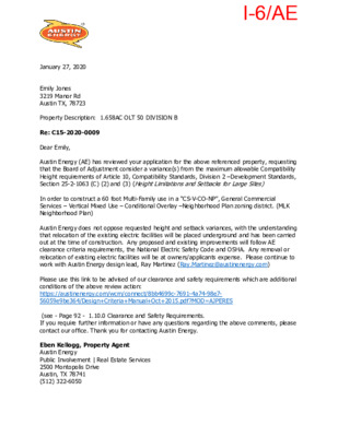
January 27, 2020 Emily Jones 3219 Manor Rd Austin TX, 78723 Re: C15-2020-0009 Dear Emily, Property Description: 1.658AC OLT 50 DIVISION B Austin Energy (AE) has reviewed your application for the above referenced property, requesting that the Board of Adjustment consider a variance(s) from the maximum allowable Compatibility Height requirements of Article 10, Compatibility Standards, Division 2 –Development Standards, Section 25-2-1063 (C) (2) and (3) (Height Limitations and Setbacks for Large Sites) In order to construct a 60 foot Multi-Family use in a “CS-V-CO-NP”, General Commercial Services – Vertical Mixed Use – Conditional Overlay –Neighborhood Plan zoning district. (MLK Neighborhood Plan) Austin Energy does not oppose requested height and setback variances, with the understanding that relocation of the existing electric facilities will be placed underground and has been carried out at the time of construction. Any proposed and existing improvements will follow AE clearance criteria requirements, the National Electric Safety Code and OSHA. Any removal or relocation of existing electric facilities will be at owners/applicants expense. Please continue to work with Austin Energy design lead, Ray Martinez (Ray.Martinez@austinenergy.com) Please use this link to be advised of our clearance and safety requirements which are additional conditions of the above review action: https://austinenergy.com/wcm/connect/8bb4699c-7691-4a74-98e7- 56059e9be364/Design+Criteria+Manual+Oct+2015.pdf?MOD=AJPERES (see - Page 92 - 1.10.0 Clearance and Safety Requirements. If you require further information or have any questions regarding the above comments, please contact our office. Thank you for contacting Austin Energy. Eben Kellogg, Property Agent Austin Energy Public Involvement | Real Estate Services 2500 Montopolis Drive Austin, TX 78741 (512) 322-6050 I-6/AE VARIANCE REQUEST: Height increase from 40 ft. to 60 ft. and requesting full uniformed 60 ft. all the way around to relieve compatibility setback requirements BOA GENERAL REVIEW COVERSHEET CASE: C15-2020-0009 BOA DATE: February 5, 2020 ADDRESS: 3219 Manor Rd OWNER: Bryan Cumby COUNCIL DISTRICT: 1 AGENT: Melissa Brown ZONING: CS-V-CO-NP (MLK) LEGAL DESCRIPTION: 1.658AC OLT 50 DIVISION B SUMMARY: erect Multi-Family ISSUES: zoning ordinance 021107-Z-12C limits development ZONING LAND USES Site CS-V-CO-NP North CS-MU-V-NP South CS-MU-CO-NP East West CS-V-CO-NP GR-V-NP Multi-Family Commercial; Multi-Family Commercial; Multi-Family Commercial Commercial NEIGHBORHOOD ORGANIZATIONS: Anberly Airport Association (Attn:Redev Srvcs) Austin Independent School District Austin Lost and Found Pets Austin Neighborhoods Council Bike Austin Del Valle Community Coalition East Austin Conservancy East MLK Combined Neighborhood Plan Contact Team Friends of Austin Neighborhoods Homeless Neighborhood Association J.J. Seabrook Neighborhood Assn. Neighborhood Empowerment Foundation Neighbors United for Progress Preservation Austin SELTexas Sierra Club, Austin Regional Group I-6/1 3 8 T H H A L F A I R P O R T 3 8 T H T O W E R V I E W M H A S M A N O R W O O D T H E O M O S S E E R T N U O R P A N N E L L E C K E R T C A L R O D G E R S M A T T I E H A R G S I T O M M I L L E R A N C H O R B E R K M A N R O N A M T I L L E R Y D E N V E R G R E E N W O O D GRANDE P A L O P I N T O CAMBRIDGE E N C I N O P A L O P I N T O P E R S H I N G L O R E T O H I G G I N S M A R T I N L U T H E R K I N G J R ! ! ± SUBJECT TRACT PENDING CASE ! ! ! ! ZONING BOUNDARY NOTIFICATIONS C15-2020-0009 CASE#: LOCATION: 3219 MANOR ROAD This product is for informational purposes and may not have been prepared for or be suitable for legal, engineering, or surveying purposes. It does not represent an on-the-ground survey and represents only the approximate relative location of property boundaries. 1 " = 333 ' This product has been produced by CTM for the sole purpose of geographic reference. No warranty is made by the City of Austin regarding specific accuracy or completeness. I-6/2 I-6/3 I-6/4 I-6/5 I-6/6 I-6/7 I-6/8 I-6/9 I-6/10 I-6/11 I-6/12 I-6/13 TO: Don Leighton-Burwell, Chair of the Board of Adjustments Members of the Board of Adjustments DATE: January 17, 2020 SUBJECT: Variance Request for 3219 Manor Road, Austin, Texas 78723 (the “Property”) Case File No. C15-2020-0009 This case was originally heard in June 2019 where the board voted to postpone a vote to allow us, the applicate, time to meet with the surrounding neighbors and Neighborhood Association to ultimately come to an agreement on the proposed variance. Following multiple postponements requested by us, due to neighborhood concerns and uncertainty on the additional ROW required by the City, we withdraw case C15-2019-0033 in November 2019. Following the initial hearing of case C15-2019-0033 we have met with the JJ Seabrook Neighborhood Association (NA) at their monthly meeting four times, held two additional meetings to hear and understand the community’s concerns regarding our proposed development and request for variance. At this time an agreement has not been made, but we are continuing to work with the neighborhood and are hopeful. The discussions had with the JJ Seabrook NA lead to a great understanding of the community’s concerns with the neighborhood and our proposed development. Increased traffic, the need for a pedestrian hybrid beacon (on the corner of Manor Rd. and Tillery St.), lack of parking, neighborhood diversity and the neighborhood park are among their concerns. Since our initial BOA hearing the building has been redesigned, and we are engaged on multiple levels to help support the community in addressing these concerns. Supplemental information for the application filed to request a variance from Section 25-2- 1063(C)(2) and (C)(3) of the City of Austin (“City”) Code of Ordinances (“Code”) also known as “Compatibility Standards”, follows. The request is for a variance from the graduated height limitations outlined in the Compatibility Standards to allow for a single, uniform height of sixty (60) feet as allowed under the assigned zoning designation of CS-V-CO-NP. Approval of the variance will allow for the placement of the new multifamily residential building in a location that fully complies with the zoning ordinance for the Property, saves a cluster of trees located in the middle of the Property, and allows for additional housing supply in this proposed vertical mixed use building. Additional information about the Property is included in the following pages. Please note, that this project is NOT at the building permit stage, so the applicant does not have signed and sealed architectural drawings of the proposed building at this time. The exhibits provided with this memorandum, while not signed and sealed, do meet the requirements of the BOA Community Guidebook. 1 I-6/14 Pursuant to the Compatibility Standards, an SF-6 or less restrictive zoned property within 540 feet or less from a property in an SF-5 or more restrictive zoning district must comply with the height limitations outlined in Section 25-2-1063. As shown on the graphic below, three (3) properties satisfy that criteria and trigger the Property’s compliance (“Triggering Property”). None of the Triggering Properties are adjacent to the Property. #1 #2 #3 Between the Property and the Triggering Property identified as #1 above is a two story multifamily residential complex. Between the Property and the Triggering Property identified as #2 is a 20,000 square foot building that houses the Motion Media Arts Center and a structure used to store tires. The Triggering Property identified as #3 faces Denver Avenue and is separated from the Property by Tillery Street. This request for a variance from the height limitations in Section 25-2-1063(C)(2) and (C)(3) of the Code should respectfully be approved for the following reasons: Reasonable Use Although the existing structures on the Property will be demolished, resulting in a vacant property for the development of the multifamily project, the Property is burdened with site constraints that constitute hardships. Specifically, the limitations imposed by Zoning Ordinance No. 021107-Z- 12c (“Zoning Ordinance”) and the existing protected and heritage trees create hardships that affect the location, layout, and size of the proposed building. By accommodating the hardships, the additional limitations of the Compatibility Standards do “not allow for a reasonable use of property”. It is important to note that Section 25-2-474 of the City Code allows for the granting of variances for the redevelopment of land. In addition, Section 25-2-474(A)(1) does not require a finding that the regulations deprive the property of “all use” but only that a “reasonable use” is disallowed. Section 25-2-1081(E) of the Austin City Code expressly allows Board of Adjustment (“BOA”) variances of Compatibility Standards. Therefore, the standard is not whether a Compatibility Standard compliant use could be developed, but instead whether the Compatibility Standards here, given the hardships on this site, do not allow for a “reasonable use.” 2 I-6/15 The variance from the height limitations would allow for a “reasonable use” by allowing development that meets the established zoning regulations for property and provide additional units (including additional affordable housing units) for much needed housing in this Imagine Austin Activity Corridor. The Zoning Ordinance prohibits access from the Property to Tillery Street, requiring that access only be allowed from Manor Road. To appropriately comply with driveway spacing requirements and considering only one side of the Property may have an access point, the location of the access drive is forced to the northwest corner of the Property. Additionally, to conform with the City Fire Code regulations, the development must also be configured in a manner that permits fire hose accessibility to all sides of the building. As a result, the multifamily development must shift toward the eastern portion of the Property for the construction of parking and fire access in the rear of the Property as shown. This shift not only reduces the size of the building, but also pushes the building closer to the Triggering Property on Denver Street. In the center of the Property, as shown, are several existing protected trees, including three heritage trees. A “super heritage” is located in the southwest corner of the Property. The intent is to design the building in a manner that not only saves these trees, but also effortlessly incorporates them into the project. The solution is to form an enhanced courtyard around the trees in the center to provide a resident amenity, and to take advantage of the large shade tree in the southwest corner for a dog park. Section 25-8-646 of the City Code requires an applicant to seek a BOA variance before seeking to remove any heritage trees. This requirement inherently makes heritage trees a hardship for BOA variance purposes. With the adoption of the Austin Strategic Mobility Plan in April 2019 the City now requires an additional Right of Way (ROW) of 10ft off the north side of the property (Manor Rd.). As a result of the additional ROW, restrictions in the Zoning Ordinance and the constraints from existing trees, the configuration options for the project are limited. The Zoning Ordinance forces the structure toward the eastern portion of the Property and reduces the square footage of the project. To save the trees in this area, the project must reduce the number of units and overall square footage to accommodate a courtyard. Compliance with the access restriction and the tree preservation requirements results in a loss of 36,180 square feet of otherwise allowable development, even under Compatibility Standards. Approval of the requested variance from the height restrictions of the Compatibility Standards would allow that lost square footage to be mitigated, compliance with neighborhood required access limitations, preserve heritage trees, while avoiding the denial of this reasonable use and allowing for optimal development potential. The City Council has recently expressed a policy determination that uses, such as that proposed for this site, along this corridor should not be subject to Compatibility Standards. Accordingly, Council has by official action determined that such use unencumbered by Compatibility Standards is a “reasonable use”. Unique to the Property As stated above, the hardships are the neighborhood zoning access limitation and presence of protected and heritage trees. This is the only Property with frontage on Tillery Street prohibited 3 I-6/16 from accessing that roadway. The Zoning Ordinance does not limit any other properties in a similar fashion. In fact, the property directly across Tillery Street from the Property does not have the same prohibition, and a similarly situated property at the corner of Tillery Street and Martin Luther King Jr Boulevard with a zoning designation of CS-MU-NP is afforded two (2) access point to Tillery Street in addition to two (2) access drives to Martin Luther King Jr Boulevard. In addition, the protected and heritage trees located centrally on this site are also unique to this site. Therefore, the combination of the access prohibition and the arrangement of protected trees makes this Property unique. Hardship – Not General to the Area The area along Manor Road between Airport Boulevard and Tillery Street is not generally burdened with such hardships. In addition, this proposed urban infill property which will not displace any existing residents and will provide a vertical mixed use is a project not generally found in this area. This Property is ideal for the vision outlined by the Council - mass transit is available in front of the Property on Manor Road; park and open space are within walking distance; and the area is need of housing. Not general to the area is Property ripe for a new housing development on urban infill that would substantially benefit the community. Area Character With apartments, commercial, and single-family residences, the character of the area is a healthy mixture of uses. However, as an Imagine Austin Activity Corridor, it is also an area that needs to focus on more housing options and opportunities and transit supportive densities. This proposed project will not alter the character of the area “adjacent to the property” but will instead enhance the area and provide much needed housing, without displacing any current residents. The area “adjacent to the property” is commercial and the proposed project will provide a suitable buffer and transition to other residential uses in the area and also be consistent with the goals for this area and corridor. The purpose of the Compatibility Standards is to minimize the impact of new construction on existing residential neighborhoods. Strict adherence to the standards based on the Triggering Properties identified above does not further the purpose of the Compatibility Standards. Triggering Properties #1 and #2 are located behind other buildings, blocking much of the visibility to this Property. Increased height will have little impact on the character of these single-family homes. The only property with direct visual of the Property is Triggering Property #3 which is diagonal across Tillery Street and facing away from the Property. With the configuration of the building on the Property adjusted to north and with trees in the southeast corner, an additional buffer is provided between the Property and Triggering Property #3 reducing any impact created by the height of the multifamily building. Conclusion In preparation for this request, we are made and will continue to make significant efforts to communicate with neighbors and interested organizations. Meetings will be held to inform the neighbors of the project and information about the implications of the requested variance will be made readily available. 4 I-6/17 The height requested is the height typically allowed for the assigned zoning designation. The only other approach to avoid the denial of reasonable use and the resulting hardships is to seek a tree variance. Section 25-8-646(A) requires that a variance, such as this one, be sought to eliminate the need to remove trees, and a rezoning is a time-consuming endeavor. The proposed multifamily project would be able to provide more benefit to the community with the approval of the requested variance; therefore, an application for a variance from the height limitations under Section 25-2-1063(C)(2) and (C)(3) was respectfully submitted. We appreciate your consideration of this request. 5 I-6/18 ORDINANCE NO. 021107-Z-12c AN ORDINANCE REZONING AND CHANGING THE ZONING MAP TO ADD A NEIGHBORHOOD PLAN COMBINING DISTRICT TO THE BASE ZONING DISTRICTS ON APPROXIMATELY 990 ACRES OF LAND GENERALLY KNOWN AS THE MLK NEIGHBORHOOD PLAN AREA ("MLK") AND TO CHANGE THE BASE ZONING DISTRICTS ON 63 TRACTS OF LAND IN MLK. BE IT ORDAINED BY THE CITY COUNCIL OF THE CITY OF AUSTIN: PART 1. The zoning map established by Section 25-2-191 of the City Code is amended to add a neighborhood plan (NP) combining district to each base zoning district within the property and to change the base zoning districts on 63 tracts of land within the property described in Zoning Case No. C14-02-0142.003, on file at the Neighborhood Planning and Zoning Department, as follows: Approximately 990 acres of land, in the City of Austin, Travis County, Texas, that includes the Oak Springs Subdistrict more particularly described and identified in the attached Exhibits "A" and "B" incorporated (the "Property"), and, as follows, into this ordinance, Oak Springs Subdistrict bounded by East 12th Street on the north, Springdale Road on the south and east, and Airport Boulevard on the west, generally known as the MLK neighborhood plan (NP) combining district, locally known as the property bounded by Anchor Lane, East 38 ¥2 Street and Manor Road on the north, East 51st Street on the east, Springdale Road on the south, and Airport Boulevard on the west, in the City of Austin, Travis County, Texas, and generally identified in the map attached as Exhibit "C". PART 2. The base zoning districts for the 63 tracts of land are changed from family residence (SF-3) district, multifamily residence low density (MF-2) district, multifamily residence medium density (MF-3) district, neighborhood office (NO) district, limited office (LO) district, neighborhood commercial (LR) district, community commercial (GR) district, general commercial services (CS) district, general commercial services-conditional overlay (CS-CO) combining district, commercial-liquor sales (CS-1) district, and limited industrial services (LI) district, to family residence-neighborhood plan (SF-3-NP) combining district, single family residence small lot-neighborhood plan (SF-4A-NP) combining district, townhouse and condominium residence-neighborhood plan (SF-6-NP) combining district, multifamily residence low density-neighborhood plan (MF-2-NP) Page 1 of 8 I-6/19 combining district, neighborhood office-mixed use-neighborhood plan (NO-MU-NP) combining district, limited office-mixed use-neighborhood plan (LO-MU-NP) combining district, neighborhood commercial-mixed use-neighborhood plan (LR-MU-NP) combining district, community commercial-neighborhood plan (GR-NP) combining district, community commercial-conditional overlay-neighborhood plan (GR-CO-NP) combining district, community commercial-mixed use-neighborhood plan (GR-MU-NP) combining district, community commercial-mixed use-conditional overlay-neighborhood plan (GR- MU-CO-NP) combining district, general commercial services-neighborhood plan (CS-NP) combining district, general commercial services-conditional overlay-neighborhood plan (CS-CO-NP) combining district, general commercial services-mixed use-neighborhood plan (CS-MU-NP) combining district, general commercial services-mixed use-conditional overlay-neighborhood plan (CS-MU-CO-NP) combining district, commercial-liquor sales- mixed use-neighborhood plan (CS-1-MU-NP) combining district, and public-neighborhood plan (P-NP) combining district, as more particularly described and identified in the chart below. TRACT 201 202 203 204 205 206 207 208 209 210 211 212 213 ADDRESS 5005 & 5029 Manor Road 2909 & 2913 E 51st Street, 5000, 5001, 5002, 5003, 5004, & 5005 Blue Spruce Circle, 5000, 5001, 5003, 5005, & 5007 Cottonwood Circle 2967, 2989, 3005, & 3007 E 51st Street (LOT 2 SEFCIK SUBD SEC 2, LOTS 1A & IB SEFCIK SUBD NO 3 & LOT 1 LONGFELLOW SUBD) 4700 Pecan Springs Road (1 1.82 ACRES OF ABS 793 SUR 20 WARNELL H ACR 1 1.82) 3015-3 107 E 51st Street & 4806-4912 Pecan Springs Road (LOTS 1-3 ROSEN ED ADDN, LOTS 1A & 2A PFAEFFLIN SUBD RESUB, LOTS 1-2 JOHNSON HELEN SUED, LOTS 1-4 POEHLMAN ACRES & 4.12 ACRES OF ABS 793 SUR 20 WARNELL H ACR 4.12) 5000 Pecan Springs Road 4809, 4813, 4905, 5001, 5003, 5005B, 5007 & 5009 Pecan Springs Road, 4926 Springdale Road (S & W OF FORT BRANCH CREEK) 0 Springdale Road (ABS 793 SUR 20 WARNELL H ACR 2.059) 4900 Springdale Road, 4926 Springdale Road (N & E OF FORT BRANCH CREEK) 3811, 3823, & 3839 Airport Boulevard 3701 & 3737 Airport Boulevard 3737 Airport Boulevard 3101-311 1 Manor Road, 21 15-2215 Airport Boulevard, 2101-2199 Theo Drive (LOTS 1-10 OLT 50 DIV B AIRPORT & MANOR RD SUBD NO 3) FROM GR, MF-2 MF-2 TO GR-MU-NP NO-MU-NP MF-2 MF-2-NP SF-3 SF-3 SF-4A-NP SF-3-NP MF-2 SF-3, MF-3 MF-2-NP SF-3-NP SF-3 GR, LO, MF- 3 CS CS CS-1 CS,GR GR-MU-CO-NP GR-MU-CO-NP CS-MU-NP CS-MU-NP CS-1-MU-NP CS-MU-NP Page 2 of 8 I-6/20 TRACT 214 ADDRESS FROM cs, cs-co, CS-1 TO CS-MU-NP 1901-2101 Airport Boulevard, 3200-3298 E MLK Boulevard, 2100- 2198 Theo Drive ( LOT 1 OLT 50 DIV B AIRPORT & MANOR RD SUBD NO 2, LOT 11-13 AIRPORT & MANOR RD SUED NO 3, LOTS C & D TRINITY SUBD, LOT 31 OLT 50 DIV A ENCINO TERRACE, LOTS 2-3, 3A, 1 1-14 & 19-22 OLT 50 DIV A DELORES SUBD, LOT A THEO DR & MANOR RD SUBD, LOT 1 OLT 50 DIV B HENRY JIM ADDN, LOT 1 AIRPORT BUSINESS PARK SUBD) 1805, 1809, 1815 & 1823 Airport Boulevard, 3223 & 3235 E MLK Boulevard 1400 Tillery Street & 3205 E 14 '/2 Street 1181, 1191 & 1199 Airport Boulevard 1153, 1165, 1181, 1191 & 1199 Airport Boulevard, 3300, 3306, & 3312 Oak Springs Drive, 3301, 331 1, & 3313 E 12th St, 0 Airport Boulevard (.322 AC OF OLT 15 DIVISION B) 3404 Oak Springs Drive 1 137-1 149 Airport Boulevard, 1 142 & 1 144 Gunter Street, 3301- 3399 Oak Springs Drive (LOTS 3 & 4 BURKE C O ADDN, LOTS 1-3 HIRSH ARRAH NEAL SUBD NO 3, LOTS 1, 2, 3A & 4 OLT 58 DIV A HIRSH ARRAH NEAL SUBD, LOT 2 OLT 57 & 60 ROBERTSON-MCCULLOUGH ADDN, LOT 1 FREEDOM HOME BAPTIST CHURCH ADDN & .5 AC OF OLT 57 & 60 DIV A) 1131, 1 133 & 1135 Airport Boulevard, 1137 Gunter St, 3706 & 3716 Goodwin Avenue 1119 Airport Boulevard, 3703 Goodwin Avenue 1921, 1923, 1925, 1927 & 1929 E 38 *A St, 3808 Manorwood Road (LOTS 24-29 BLK A OLT 35 & 36 DIV C MANOR HILL & LOT 1 MANOR HILL ADDN RESUB OF BLK F & PART OF BLK A) 2011 & 2027 Anchor Lane, 3138, 3200, 3220, 3300, & 3330 Manor Road 3 1 12-3 128 Manor Road (LOT 8 BLK D OLT 35 & 36 DIV C & PART OF SERVICE WAY MANOR HILL) 3121, 3207 & 3313 Manor Road 32 19 Manor Road 3303 Manor Road, 2205 Tillery Street 2200 Tillery Street 3317 Manor Road, 2212 Palo Pinto Drive 3401 & 3403 Manor Road 3501 Manor Road 351 1 & 3515 Manor Road, 0 Manor Road (.48 ACR OF LOT 2-3 & 14 BLK 1 OLT 51-52 DIV B CREST HAVEN ADDN) 2215 & 2263 EM Franklin Avenue, 3607 Manor Road 22 1 1 & 22 1 3 EM Franklin Avenue 22 1 0 & 2220 EM Franklin Avenue, 2226 Pershing Drive 2101, 2107 & 2109 EM Franklin Avenue 0 Pershing Drive (PT OF LTS 1-2 & 46-47 BLK D & APPROX 1 .00 AC OLT 5 1 DIV B MANOR RD ADDN, AD J VAC PALO PINTO DR) 0 Palo Pinto Drive (APPROX 1.00 AC OF OLT 51 DIV B MANOR RJDADDN) LR CS CS CS SF-3 CS Page 3 of 8 GR, SF-3 GR-MU-NP NO, SF-3 CS-1 LI, CS, GR, LO LR-MU-NP CS-1-MU-NP CS-MU-NP LR-MU-NP CS-MU-NP CS-MU-NP CS-MU-NP GR-MU-CO-NP CS-MU-NP CS, CS-1, GR CS-NP GR CS-CO CS-CO LO LR LO, SF-3 LO GR,LO GR-NP CS-CO-NP CS-CO-NP LO-MU-NP GR-CO-NP GR-CO-NP LO-NP GR-NP GR LI CS, GR, SF-3 LO, CS, CS-1 SF-3 GR-NP CS-MU-CO-NP LO-MU-NP LO-MU-NP P-NP SF-3 P-NP 215 216 217 218 219 220 221 222 223 224 225 226 227 228 229 230 231 232 233 234 235 236 237 238 239 I-6/21 TRACT 240 241 243 244 245 246 247 248 249 253 254 255 256 257 258 259 260 261 262 263 264 265 266 267 1904 EM Franklin Avenue ADDRESS 35 10-3520 E MLK Boulevard (LOT 1 OLT 51-52 DIV B RAOCH MAUDE E SUED) 1704, 1706, 1710, 1804 & 1812 EM Franklin Avenue, 3417 & 3515 E MLK Boulevard, 0 E MLK Boulevard (ACR 2.40 OLT 23 DIVISION B), 0 EM Franklin Avenue (1.375 ACR OLT 23 DIVISION B), 0 E 17th Street (96 x 104 FEET OLT 23 DIVISION B, .33 AC OF OLT 23 DIVISION B) 1812 EM Franklin Avenue 3601 & 3609 E MLK Boulevard, 1807 EM Franklin Avenue 3707 E MLK Boulevard 1707, 1801 & 1803 Overhill Drive, 1800, 1802 & 1806 Springdale Road 1808 & 1810 Springdale Road, 4501, 4505, 4507 & 4509 E MLK Boulevard 1801 EM Franklin Avenue 0 E 12th Street (EVERGREEN CEMETERY) 3317 E 12th Street 4000 & 4008 El 2th Street 4104 E 12th Street 41 12-4122 E 12th Street 1308 Springdale Road 1200, 1202 & 1204 Springdale Road, 4122 E 12th Street 4121-4127 E 12th St (More specifically identified in exhibit "D") 4013-41 19 E 12th St (More specifically identified in exhibit "D") 1 152 Springdale Road, 3703 & 4003 E 12th St 3500-3612 Oak Springs Drive (LOTS 1-9 NUEVA VIDA I-A, LOT 15 NUEVA VIDA II, LOT 3 HOBBS ADDN SEC 2 & 5.439 AC OUT OF OLT 17 DIV B) 3301 Pennsylvania Avenue (LOT 17 & ADJ 31.4 FEET OF VACATED TILLERY STREET OLT 16 DIV B HUSTON SAM HEIGHTS) 1 144 Gunter Street 1 143, 1 145, & 1 147 Gunter Street, 1 144 Wayneroy Drive, 3603 & 3605 Abbate Circle 1076 Springdale Road (LOT 2 OLT 57 & 60 DIV A SPRINGDALE PARK) FROM GR GR TO SF-3-NP SF-6-NP SF-3, MF-3 SF-3-NP CS GR NO, SF-3 LR,LO GR-NP GR-NP LO-MU-NP LO-MU-NP LR,CS GR-NP MF-3 SF-3 SF-3 CS LR SF-3 SF-3 CS-1,LR, MF-3, SF-3 SF-3 SF-3 SF-3 MF-2 SF-6-NP P-NP LR-MU-NP SF-6-NP SF-6-NP SF-3-NP P-NP GR-MU-NP GR-MU-NP SF-6-NP P-NP SF-6-NP LO,GR SF-6-NP MF-3, CS MF-3 SF-3-NP SF-3-NP GR GR-NP Page 4 of 8 I-6/22 PART 3. The following applies to an existing legal lot with single-family residential use within the boundaries of the NP combining district: 1. The minimum lot area is 2,500 square feet. 2. The minimum lot width is 25 feet. 3. For a lot with an area of 3,500 square feet or less, the impervious coverage may not exceed 65 percent. PART 4. Cottage special use is permitted on lots in residential districts within the boundaries of the Oak Springs Subdistrict as set forth in Sections 25-2-1442 through 25-2- 1444 of the Code. PART 5. Urban home special use is permitted on lots in residential districts within the boundaries of the Oak Springs Subdistrict as set forth in Sections 25-2-1422 through 25-2- 1424 of the Code. .PART 6. Tracts 203, 205, 206, 207, 243, 257 and 263 may be developed as a residential infill special use as set forth in Sections 25-2-1532 through 25-2-1534 of the Code. PART 7. Tracts 201, 208 through 237, 244 through 248, 254, 259, 260 and 267 may be developed as a neighborhood mixed use building special use as set forth in Sections 25-2- 1502 through 25-2-1504 of the Code. PART 8. Tracts 222 and 233 may be developed as a neighborhood urban center special use as set forth in Sections 25-2-1521 through 25-2-1524 of the Code. PART 9. The Property within the boundaries of the conditional overlay-combining district established by this ordinance is subject to the following conditions. 1. The following conditions apply to Tract 227: A. Vehicular access from the Property to Tillery Street is prohibited. All vehicular access, to the Property shall be from other adjacent public streets or through other adjacent property. B. A 15-foot wide vegetative buffer shall be provided and maintained along the east property line adjacent to Tillery Street. Improvements permitted within the buffer zone are limited to drainage, underground utility improvements or those improvements that may be otherwise required by the City of Austin or specifically authorized in this ordinance. Page 5 of 8 I-6/23 2. The following conditions apply to Tract 228: A 15-foot wide vegetative buffer shall be provided and maintained along the west property line adjacent to Tillery Street and along the south property line adjacent to the property developed or zoned residential. Improvements permitted within the buffer zone are limited to drainage, underground utility improvements or those improvements that may be otherwise required by the City of Austin or specifically authorized in this ordinance. 3. The following uses are prohibited uses on Tracts 223, 230 and 231: Automotive rentals Automotive washing (of any type) Drop-off recycling collection facility Funeral services Outdoor sports and recreation Automotive repair services Automotive sales Exterminating services Outdoor entertainment Pawn shop services 4. The following uses are prohibited uses on Tract 227: Adult oriented businesses Automotive sales Convenience storage Equipment repair services Funeral services Outdoor entertainment Pawn shop services Agricultural sales and services Campground Drop-off recycling collection facility Exterminating services Kennels Outdoor sports and recreation 5. The following uses are prohibited uses on Tract 228: Adult oriented businesses Automotive sales Campground Drop-off recycling collection facility Equipment repair services Exterminating services Kennels Limited warehousing and distribution Monument retail sales Outdoor sports and recreation Transitional housing Veterinary services Agricultural sales and services Building and maintenance services Convenience storage Electronic prototype assembly Equipment sales Funeral services Laundry services Maintenance and service facilities Outdoor entertainment Pawn shop services Vehicle storage Page 6 of 8 I-6/24 6. The following uses are prohibited uses on Tract 235: Adult oriented businesses Automotive washing (of any type) Commercial blood plasma center Construction sales and services Custom manufacturing Equipment sales Laundry services Maintenance and service facilities Service station Agricultural sales and services Campground Commercial off-street parking Convenience storage Equipment repair services Drop-off recycling collection facility Limited warehousing and distribution Pawn shop services Vehicle storage 7. Drive-in service as an accessory use to commercial uses is a prohibited use on Tracts 208, 209 and 235. 8. The following uses are conditional uses on Tract 235: Automotive sales Guidance services Kennels Outdoor sports and recreation Exterminating services Hotel-motel Monument retail sales Residential treatment 9. The following uses are prohibited uses on Tracts 208 and 209: Automotive rentals Automotive repair services Automotive sales Automotive washing (of any type) Pawn shop services Service station Except as specifically restricted under this ordinance, the Property may be developed and used in accordance with the regulations established for the respective base districts and other applicable requirements of the City Code. PART 10. The Council waives the requirements of Sections 2-2-3 and 2-2-7 of the City Code for this ordinance. Page 7 of 8 I-6/25 PART 11. This ordinance takes effect on November 18, 2002. PASSED AND APPROVED November 7 2002 APPROVED: City Attorney Gustavo L. Garcia Mayor AJtlIA^ IJ Shirley W. Brown City Clerk Page 8 of 8 I-6/26 N W fir'* MLK Neighborhood Plan Combining District Case #014-02-0142.003 wo** * I-6/27 Neighborhood Planning Area Boundaries Subdistrict Boundaries Springdale Neighborhood Planning Area MLK Neighborhood Planning Area East MLK Combined Planning Area Neighborhood Planning Area and Subdistrict Boundaries This map has been produced by the City of Austin and is a wokring staff map and is not warranted for any other use. No warranty is made by the City regarding its accuracy or completeness. Reproduction is not permitted without written permission from the Neighborhood Planning and Zoning Department. I-6/28 -,.^lu-/;// $$&'/ ///-<-/ /"( - / '- /• N /I ^T=160Q ^^gfe; ' RIIR-lPrTTRAPT V////////A ZONING £&&£ 1 T C- . ^^, . i - - • ^~*~- ^-^~ * r».T^ ' ^ ZONING BOUNDARY CASEMGR: T. BOLT CASE #: C14-02-0142.003 ADDRESS: MLK NPCD -' ^ — - / _ •- t-r^ . CITY GRID NUMBER M21-25 ,^-tt . .** 'ri&Ji — M - K£ir f SUBJECT AREA (acrfts): M/A 'tisXJiUJ'LUi), ".m»^T •*.»<'. "•••'^^'•"". "j u . '. w~- LMII — .«».•'...— DATE' °2"09 INTLS: SM I-6/29 g> o> rvj I-6/30 Variance Request 3219 Manor Rd. by Mid-City Development I-6/31 3219 Manor Rd. Site Conditions • Site conditions: • Size and Shape: This rectangular parcel of land is approximately 1.6 acres • Topography: topography and has a few groupings of large trees and multiple heritage trees. The land parcel has almost flat • Flood Plain: Does not fall into the Greater Austin FEMA floodplain • Zoning: The land parcel is currently zoned CS-V-CO-NP with an MU option. Zoning allows for 2.0 FAR with 72,222.50 sf resulting in 144,444.96 sf maximum FAR I-6/32 3219 Manor RD: Triggering Properties Setbacks SE: Southeastern compatibility setback due to SF3 across street and diagonal from subject property NW: Northwestern compatibility setback due to SF3 across street, diagonal, and behind another building from subject property SW: Southwestern compatibility setback due to SF3 diagonal and behind another building(s) from subject property Combined SE, NW, and SW: Three triggering properties on almost all sides of the subject property I-6/33 SITE SPECIFIC HARDSHIP Section 25-8-646 (A) requires a variance be sought to eliminate the need to remove heritage trees. Heritage trees on property, included in main build pad location. • 25” Post Oak • 29” Post Oak • 32” Post Oak I-6/34 UNATTAINABLE AREA DUE TO SITE CONDITIONS AND RESTRICTIONS SITE SPECIFIC HARDSHIP & Ordinance restriction of no vehicular access off Tillery St. Heritage trees on property, included in main build pad location ASMP adopted in April 2019 - Required 10ft ROW Ordinance required vegetative buffer on Tillery I-6/35 Site Specific Restriction Impact UNATTAINABLE AREA DUE TO SITE CONDITIONS AND RESTRICTIONS Ordinance restriction of no vehicular access off Tillery St. -10,000 SF Heritage trees on property, including in main build pad location -30,800 SF ASMP adopted in April 2019 - Required 10ft ROW -11,500 SF Ordinance required vegetative buffer on Tillery -12,500 SF I-6/36 Building Design ( Manor Rd) I-6/37 Building Design (Manor & Tillery St.) I-6/38 Building Design (Tillery St.) I-6/39 Building Design (Tire Shop) I-6/40 Building Design Street View (Manor St.) I-6/41 Building Design Street View (Tillery St.) I-6/42 Allowable Height Per Compatibility Setback (in blue) 17’ 4.5” **All information is subject to change** I-6/43 Allowable Height Per Compatibility Setback (in blue) Height Requested (in fuchsia) 17’- 4.5” Max **All information is subject to change** I-6/44